Aerial photograph 432673
Vertical aerial view from the satellite perspective of the playground Otto-Meinecke-Strasse - Benno-Elkan-Allee - Kippenberger Weg in the district Westpark in Dortmund in the state North Rhine-Westphalia, Germany
DORTMUND 27.09.2019
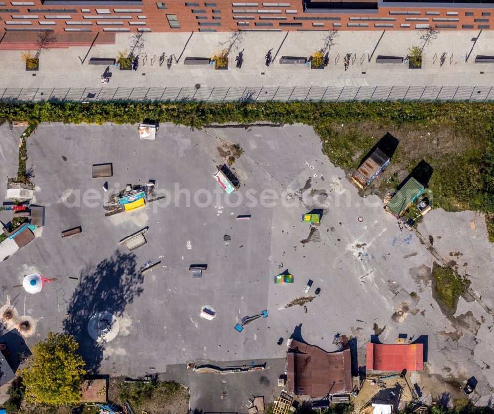
Vertical aerial view from the satellite perspective of the playground Otto-Meinecke-Strasse - Benno-Elkan-Allee - Kippenberger Weg in the district Westpark in Dortmund in the state North Rhine-Westphalia, Germany. Photo: Hans Blossey
Aerial image ID: 432673
Image resolution: 6720 x 5643 pixels x 24 bit
compressed image file size: 14,29 MB
Image file size: 108,49 MB
Sources and credit: © euroluftbild.de/Hans Blossey
The recording is permitted due to the so-called freedom of panorama according to § 59 UrhG. The provision of Section 59 UrhG conforms to the directive based on Art. 5 Para. 3 Letter c of Directive 2001/29/EC of the European Parliament and of the Council of May 22, 2001 on the harmonization of certain aspects of copyright and related property rights in the information society ("InfoSoc-RL") to be interpreted. The directive-compliant interpretation shows that aerial photographs are also covered by § 59 Para. 1 UrhG and the use of tools does not lead out of the protective barrier. www.klebba.legal
Position: 51° 30' 53'' N / 7° 27' 4.99'' E