Aerial photograph 154237
Vertical aerial photo of the city districts Birkenhöhe and Eichwerder of Bernau, that are seperated by the motor way A 11, and Zepernick of the Panke Valley community
BERNAU 07.04.2010
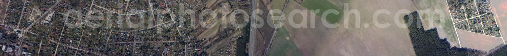
Vertical aerial photo of the city districts Birkenhöhe and Eichwerder of Bernau, that are seperated by the motor way A 11, and Zepernick of the Panke Valley community. www.bernau.de / www.panketal.de Photo: Henrik Pohl
Aerial image ID: 154237
Image resolution: 19437 x 2170 pixels x 24 bit
compressed image file size: 12,85 MB
Image file size: 120,67 MB
Sources and credit: © euroluftbild.de/Henrik Pohl
The recording is permitted due to the so-called freedom of panorama according to § 59 UrhG. The provision of Section 59 UrhG conforms to the directive based on Art. 5 Para. 3 Letter c of Directive 2001/29/EC of the European Parliament and of the Council of May 22, 2001 on the harmonization of certain aspects of copyright and related property rights in the information society ("InfoSoc-RL") to be interpreted. The directive-compliant interpretation shows that aerial photographs are also covered by § 59 Para. 1 UrhG and the use of tools does not lead out of the protective barrier.