Aerial photograph 172969
View of the six-lane extension of the A40 between junctions Gelsenkirchen and Bochum-Stahlhausen. As part of the expansion sites created several new bridges
BOCHUM OT STAHLHAUSEN 28.10.2012
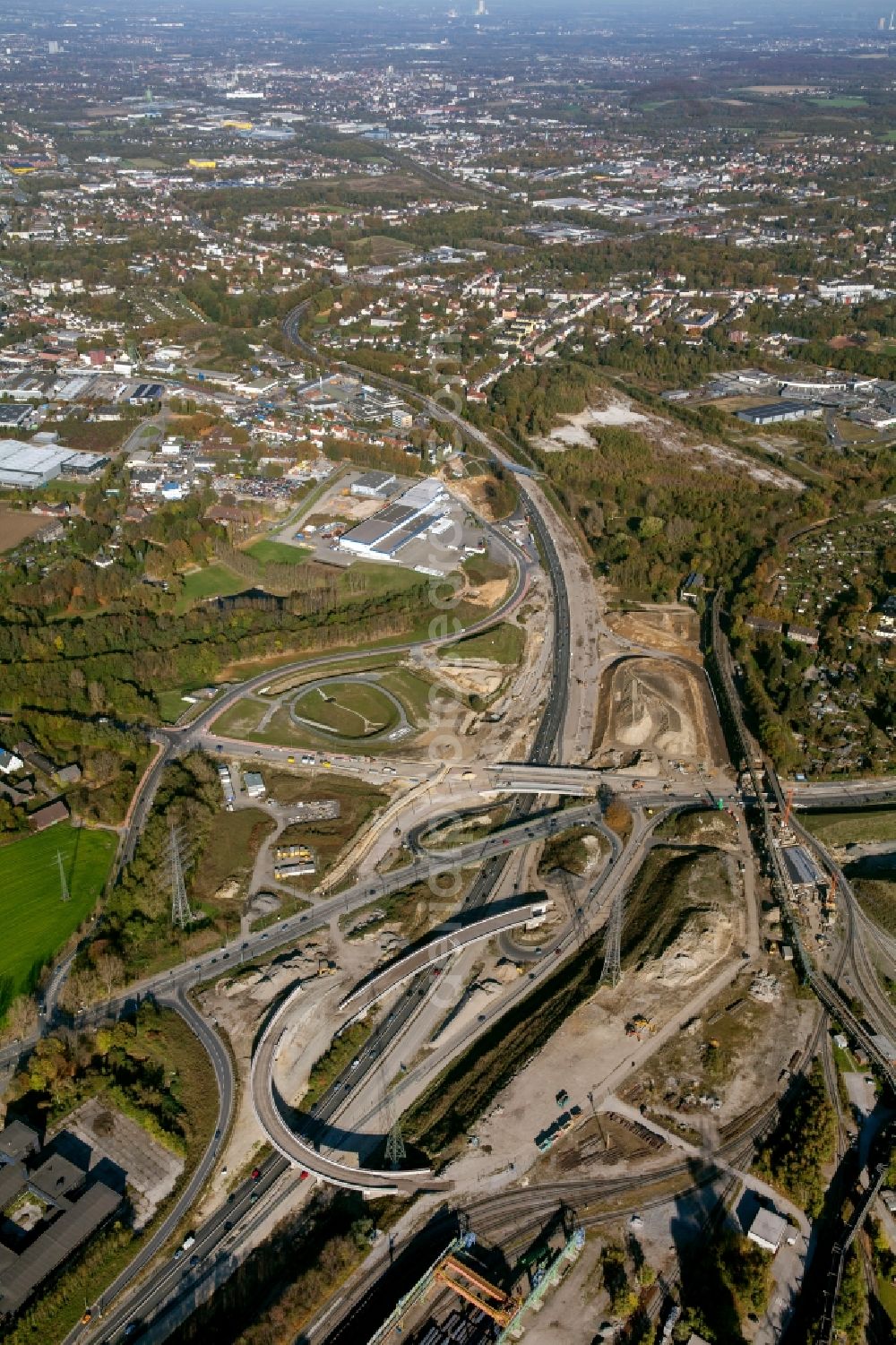
View of the six-lane extension of the A40 between junctions Gelsenkirchen and Bochum-Stahlhausen. As part of the expansion sites created several new bridges. Photo: Hans Blossey
Aerial image ID: 172969
Image resolution: 3744 x 5616 pixels x 24 bit
compressed image file size: 8,8 MB
Image file size: 60,16 MB
Sources and credit: © euroluftbild.de/Hans Blossey
The recording is permitted due to the so-called freedom of panorama according to § 59 UrhG. The provision of Section 59 UrhG conforms to the directive based on Art. 5 Para. 3 Letter c of Directive 2001/29/EC of the European Parliament and of the Council of May 22, 2001 on the harmonization of certain aspects of copyright and related property rights in the information society ("InfoSoc-RL") to be interpreted. The directive-compliant interpretation shows that aerial photographs are also covered by § 59 Para. 1 UrhG and the use of tools does not lead out of the protective barrier. www.klebba.legal
Position: 51° 28' 35.6'' N / 7° 10' 14.35'' E