Aerial image 181716
View of the mountain peak of the Brocken in the Harz - Mountains in the state of Saxony-Anhalt. The rock band the Brocken is designated as a national park and nature reserve. The radio and transmitter towers of Deutsche Telekom are visible from afar .
BROCKEN 06.06.2013
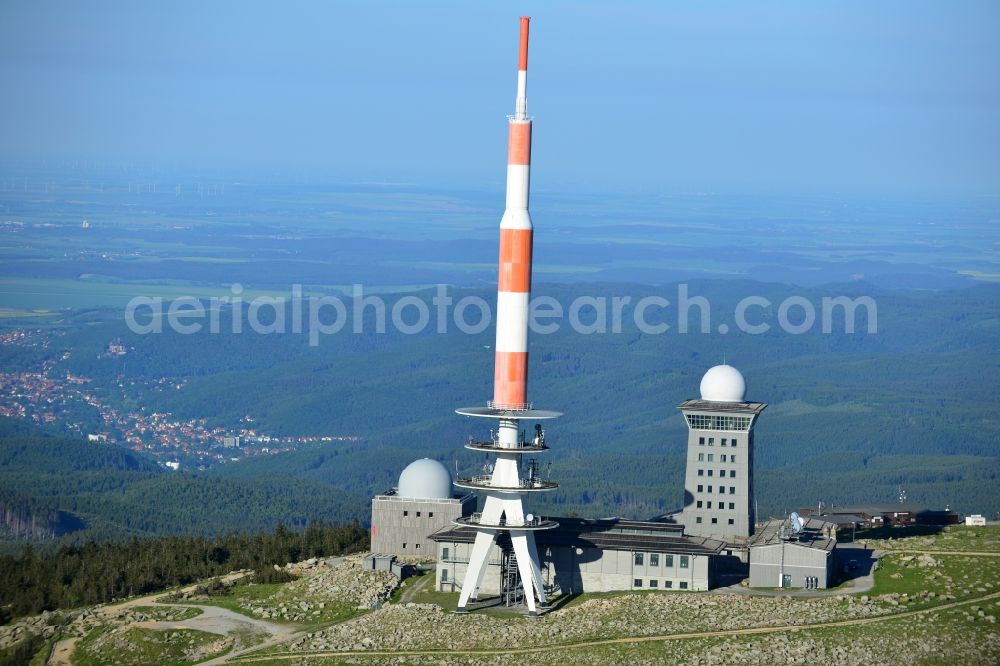
View of the mountain peak of the Brocken in the Harz - Mountains in the state of Saxony-Anhalt. The rock band the Brocken is designated as a national park and nature reserve. The radio and transmitter towers of Deutsche Telekom are visible from afar ..
Aerial image ID: 181716
Image resolution: 7360 x 4912 pixels x 24 bit
compressed image file size: 7,57 MB
Image file size: 103,43 MB
Sources and credit: © euroluftbild.de/Robert Grahn
The recording is permitted due to the so-called freedom of panorama according to § 59 UrhG. The provision of Section 59 UrhG conforms to the directive based on Art. 5 Para. 3 Letter c of Directive 2001/29/EC of the European Parliament and of the Council of May 22, 2001 on the harmonization of certain aspects of copyright and related property rights in the information society ("InfoSoc-RL") to be interpreted. The directive-compliant interpretation shows that aerial photographs are also covered by § 59 Para. 1 UrhG and the use of tools does not lead out of the protective barrier. www.klebba.legal