Aerial photograph 230159
View of Kerben in the state of Rhineland-Palatinate. The agricultural borough and municipiality is located in the county district of Mayen-Koblenz, in the Niedermaifelder Senke region and the South of the federal motorway A48, and is surrounded by meadows and rapeseed fields
KERBEN 19.05.2011
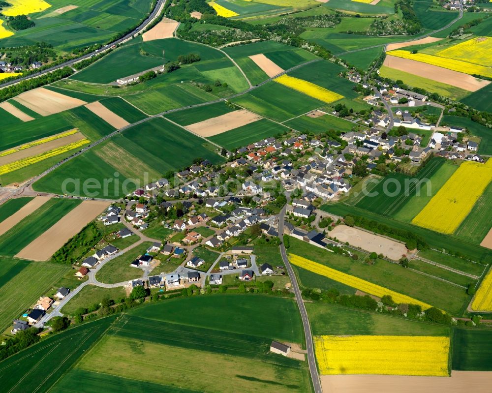
View of Kerben in the state of Rhineland-Palatinate. The agricultural borough and municipiality is located in the county district of Mayen-Koblenz, in the Niedermaifelder Senke region and the South of the federal motorway A48, and is surrounded by meadows and rapeseed fields. www.maifeld.de Photo: Gerhard Launer
Aerial image ID: 230159
Image resolution: 5906 x 4724 pixels x 24 bit
compressed image file size: 10,78 MB
Image file size: 79,82 MB
Sources and credit: © euroluftbild.de/Gerhard Launer
The recording is permitted due to the so-called freedom of panorama according to § 59 UrhG. The provision of Section 59 UrhG conforms to the directive based on Art. 5 Para. 3 Letter c of Directive 2001/29/EC of the European Parliament and of the Council of May 22, 2001 on the harmonization of certain aspects of copyright and related property rights in the information society ("InfoSoc-RL") to be interpreted. The directive-compliant interpretation shows that aerial photographs are also covered by § 59 Para. 1 UrhG and the use of tools does not lead out of the protective barrier. www.klebba.legal
Position: 50° 18' 37.39'' N / 7° 21' 23.69'' E