Aerial photograph 227333
View of the Eller part of the borough and municipiality of Ediger-Eller in the state of Rhineland-Palatinate. The official tourist resort and wine-growing town is part of the Cochem-Zell county district and is located on the left riverbank of the Moselle. It consists of the two parts Ediger (in the East) and Eller (in the West). Eller is located on the foot of the Calmont - the steepest wine hill of Europe
EDIGER-ELLER 29.05.2011
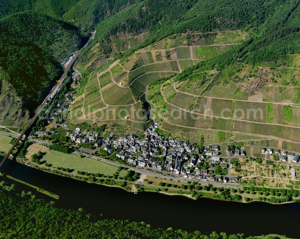
View of the Eller part of the borough and municipiality of Ediger-Eller in the state of Rhineland-Palatinate. The official tourist resort and wine-growing town is part of the Cochem-Zell county district and is located on the left riverbank of the Moselle. It consists of the two parts Ediger (in the East) and Eller (in the West). Eller is located on the foot of the Calmont - the steepest wine hill of Europe. www.ediger-eller.de Photo: Gerhard Launer
Aerial image ID: 227333
Image resolution: 5906 x 4724 pixels x 24 bit
compressed image file size: 14,76 MB
Image file size: 79,82 MB
Sources and credit: © euroluftbild.de/Gerhard Launer
The recording is permitted due to the so-called freedom of panorama according to § 59 UrhG. The provision of Section 59 UrhG conforms to the directive based on Art. 5 Para. 3 Letter c of Directive 2001/29/EC of the European Parliament and of the Council of May 22, 2001 on the harmonization of certain aspects of copyright and related property rights in the information society ("InfoSoc-RL") to be interpreted. The directive-compliant interpretation shows that aerial photographs are also covered by § 59 Para. 1 UrhG and the use of tools does not lead out of the protective barrier. www.klebba.legal
Position: 50° 6' 2.35'' N / 7° 8' 39.13'' E