Aerial image 249524
Traffic flow at the intersection- motorway A30 and federal highway B239 in the Southeast of Kirchlengern in the state of North Rhine-Westphalia. The roads and the architectural distinct interchange are surrounded by trees and agricultural fields and located on a pond
KIRCHLENGERN 05.08.2015
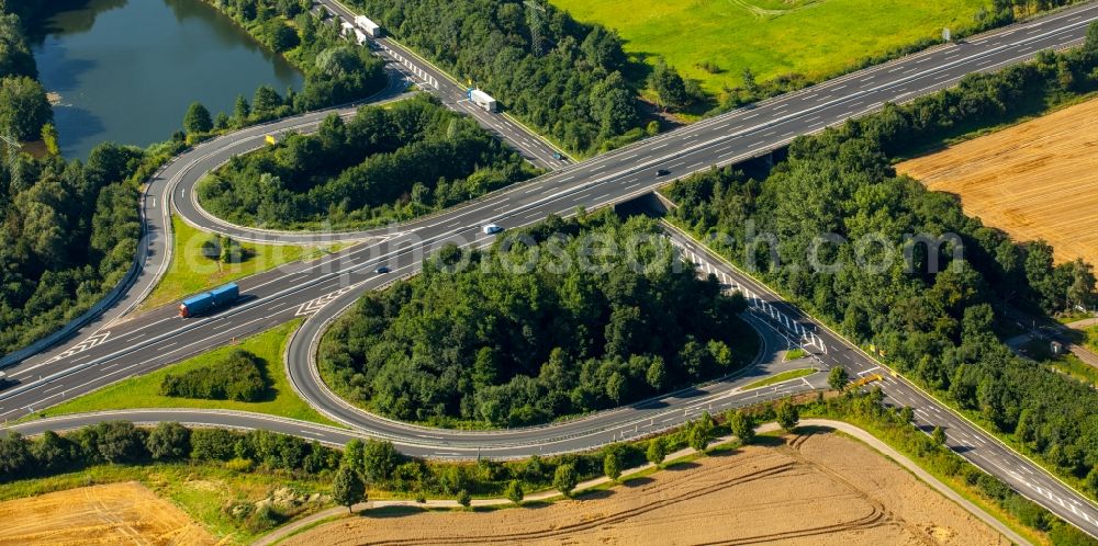
Traffic flow at the intersection- motorway A30 and federal highway B239 in the Southeast of Kirchlengern in the state of North Rhine-Westphalia. The roads and the architectural distinct interchange are surrounded by trees and agricultural fields and located on a pond. www.kirchlengern.de Photo: Hans Blossey
Aerial image ID: 249524
Image resolution: 5760 x 2869 pixels x 24 bit
compressed image file size: 8,03 MB
Image file size: 47,28 MB
Sources and credit: © euroluftbild.de/Hans Blossey
The recording is permitted due to the so-called freedom of panorama according to § 59 UrhG. The provision of Section 59 UrhG conforms to the directive based on Art. 5 Para. 3 Letter c of Directive 2001/29/EC of the European Parliament and of the Council of May 22, 2001 on the harmonization of certain aspects of copyright and related property rights in the information society ("InfoSoc-RL") to be interpreted. The directive-compliant interpretation shows that aerial photographs are also covered by § 59 Para. 1 UrhG and the use of tools does not lead out of the protective barrier. www.klebba.legal
Position: 52° 11' 19.39'' N / 8° 39' 44.3'' E