Aerial image 222328
Three level panorama landscape and Black Forest around Buehl in the state of Baden-Wuerttemberg. The compound and course of the Golfclub Urloffen e.V. are located in the foreground. The landscape with its agricultural fields of the Rhine flatlands, the foothills of the Black Forest with its fruit and vegetable fields and the forestry areas of the mountains of the Black Forest are located behind it
APPENWEIER 22.06.2011
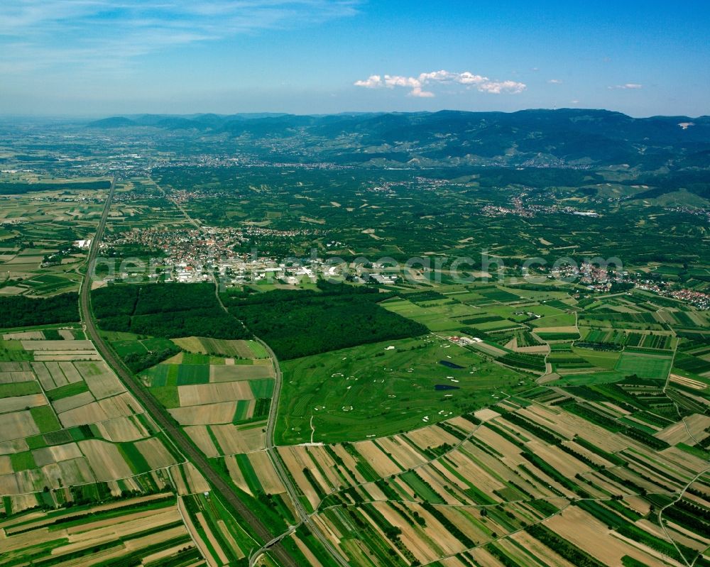
Three level panorama landscape and Black Forest around Buehl in the state of Baden-Wuerttemberg. The compound and course of the Golfclub Urloffen e.V. are located in the foreground. The landscape with its agricultural fields of the Rhine flatlands, the foothills of the Black Forest with its fruit and vegetable fields and the forestry areas of the mountains of the Black Forest are located behind it. Photo: Gerhard Launer
Aerial image ID: 222328
Image resolution: 3937 x 3150 pixels x 24 bit
compressed image file size: 7,15 MB
Image file size: 35,48 MB
Sources and credit: © euroluftbild.de/Gerhard Launer
The recording is permitted due to the so-called freedom of panorama according to § 59 UrhG. The provision of Section 59 UrhG conforms to the directive based on Art. 5 Para. 3 Letter c of Directive 2001/29/EC of the European Parliament and of the Council of May 22, 2001 on the harmonization of certain aspects of copyright and related property rights in the information society ("InfoSoc-RL") to be interpreted. The directive-compliant interpretation shows that aerial photographs are also covered by § 59 Para. 1 UrhG and the use of tools does not lead out of the protective barrier. www.klebba.legal
Position: 48° 34' 6.95'' N / 7° 59' 22.07'' E