Aerial image 222316
The technology and business incubator vineyard is located in the northeast of Halle (Saale) in Saxony-Anhalt. For Weinberg campus of the Martin-Luther-University Halle include different building containing classrooms and lecture halls. On the site you will find the Max Planck Institute of Microstructure Physics, the Leibniz Institute of Plant Biochemistry, the Geological Garden Hall and the University Hospital Halle. The Doehlauer Heath, an urban forest, forms the natural border of the university town. In the foreground the historic tourist restaurant Peissnitzhaus and Planetarium Sigmund Jaehn on the island Peissnitz can be seen
HALLE (SAALE) 01.08.2014
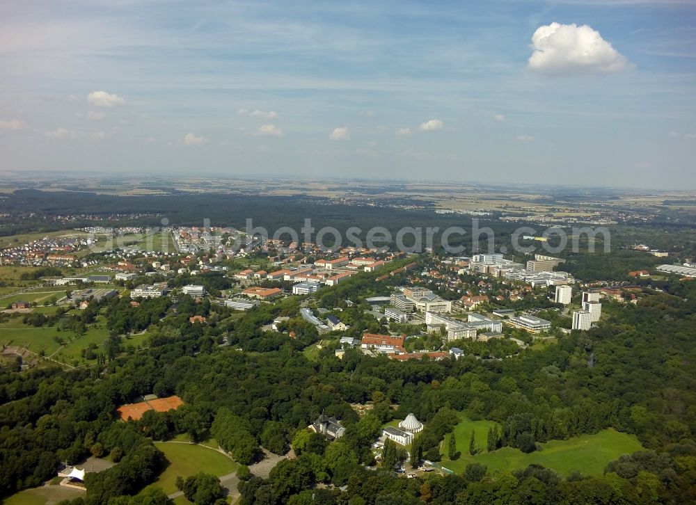
The technology and business incubator vineyard is located in the northeast of Halle (Saale) in Saxony-Anhalt. For Weinberg campus of the Martin-Luther-University Halle include different building containing classrooms and lecture halls. On the site you will find the Max Planck Institute of Microstructure Physics, the Leibniz Institute of Plant Biochemistry, the Geological Garden Hall and the University Hospital Halle. The Doehlauer Heath, an urban forest, forms the natural border of the university town. In the foreground the historic tourist restaurant Peissnitzhaus and Planetarium Sigmund Jaehn on the island Peissnitz can be seen. www.halle.de / www.planetarium-halle.info / www.peissnitzhaus.de / www.uni-halle.de / www.ipb-halle.de / www.mpg.de Photo: Maike Glöckner
Aerial image ID: 222316
Image resolution: 4000 x 2908 pixels x 24 bit
compressed image file size: 8,43 MB
Image file size: 33,28 MB
Sources and credit: © euroluftbild.de/Maike Glöckner
The recording is permitted due to the so-called freedom of panorama according to § 59 UrhG. The provision of Section 59 UrhG conforms to the directive based on Art. 5 Para. 3 Letter c of Directive 2001/29/EC of the European Parliament and of the Council of May 22, 2001 on the harmonization of certain aspects of copyright and related property rights in the information society ("InfoSoc-RL") to be interpreted. The directive-compliant interpretation shows that aerial photographs are also covered by § 59 Para. 1 UrhG and the use of tools does not lead out of the protective barrier. www.klebba.legal
Position: 51° 29' 42.32'' N / 11° 56' 34.17'' E