Aerial image 198264
The Strahlau peninsula in Berlin-Friedrichshain is a tongue of land between the Spree and Rummelsburger bay. In recent years, created high-quality residential property with some direct connection to the popular waterfront. Sport and leisure boats can moor at various piers. Am Treptower - the riverside is called the Isle of Youth, also abbey island. On the left side the high-rise is - Treptower to see
BERLIN 27.07.2001
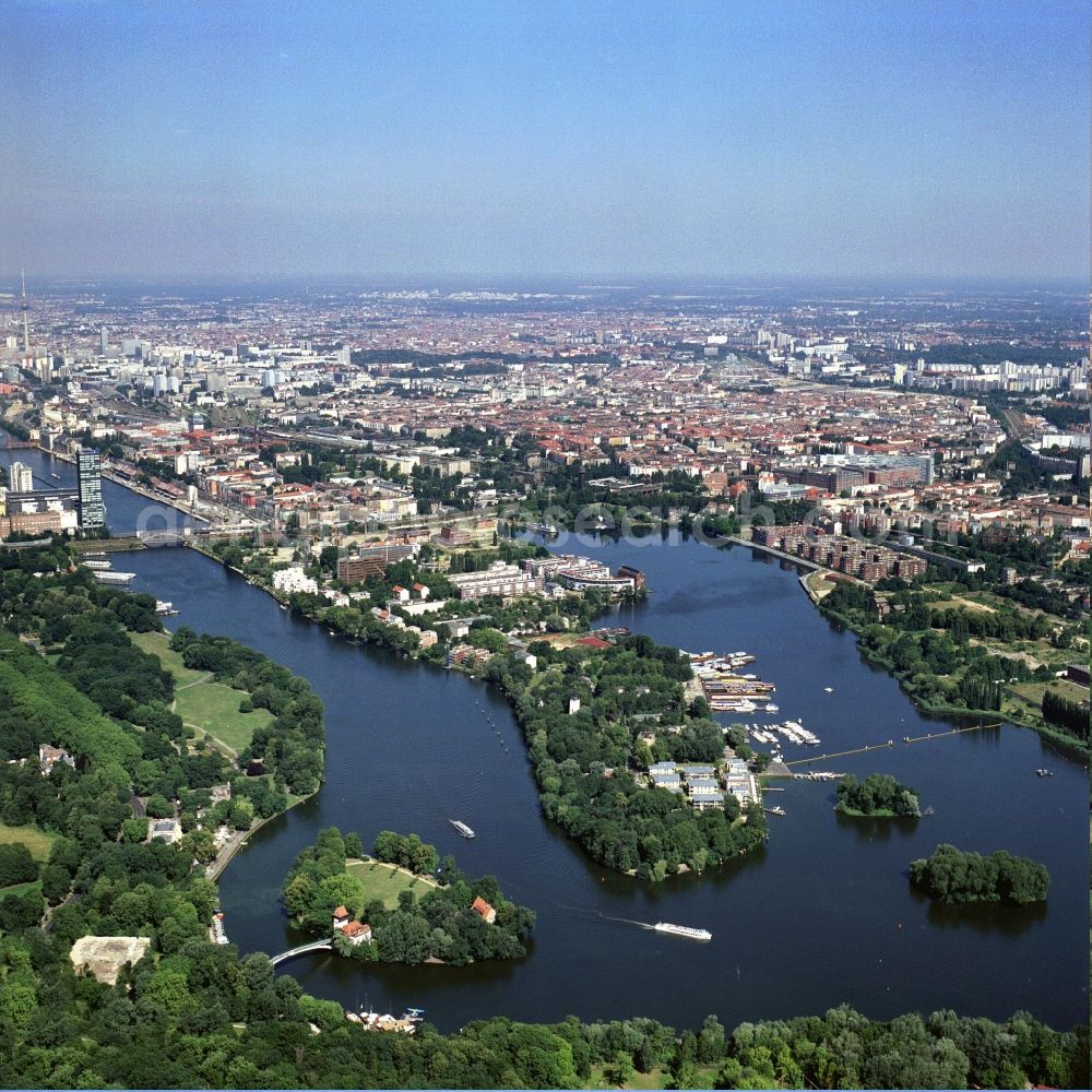
The Strahlau peninsula in Berlin-Friedrichshain is a tongue of land between the Spree and Rummelsburger bay. In recent years, created high-quality residential property with some direct connection to the popular waterfront. Sport and leisure boats can moor at various piers. Am Treptower - the riverside is called the Isle of Youth, also abbey island. On the left side the high-rise is - Treptower to see. www.inselberlin.de Photo: Henrik Pohl
Aerial image ID: 198264
Image resolution: 4328 x 4328 pixels x 24 bit
compressed image file size: 3,07 MB
Image file size: 53,59 MB
Sources and credit: © euroluftbild.de/Henrik Pohl
The recording is permitted due to the so-called freedom of panorama according to § 59 UrhG. The provision of Section 59 UrhG conforms to the directive based on Art. 5 Para. 3 Letter c of Directive 2001/29/EC of the European Parliament and of the Council of May 22, 2001 on the harmonization of certain aspects of copyright and related property rights in the information society ("InfoSoc-RL") to be interpreted. The directive-compliant interpretation shows that aerial photographs are also covered by § 59 Para. 1 UrhG and the use of tools does not lead out of the protective barrier.
Position: 52° 31' 13.43'' N / 13° 25' 2.63'' E