Aerial image 183438
The Palestinian town of Rantis in the West Bank. The town lies next to the Green Line, the demarcation line between Israel and the West Bank following the Six-Day War. The line was set out in the 1949 Armistice Agreements
RANTIS 18.02.2013
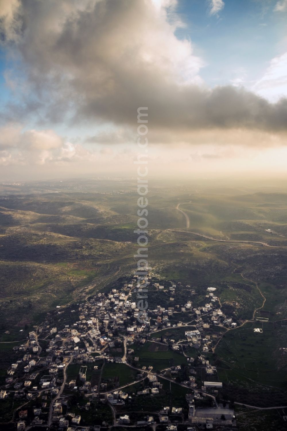
The Palestinian town of Rantis in the West Bank. The town lies next to the Green Line, the demarcation line between Israel and the West Bank following the Six-Day War. The line was set out in the 1949 Armistice Agreements. Photo: Basti Hansen
Aerial image ID: 183438
Image resolution: 3170 x 4755 pixels x 24 bit
compressed image file size: 9,86 MB
Image file size: 43,13 MB
Sources and credit: © euroluftbild.de/Basti Hansen
All information gathered here in picture and word represent a non-binding information offer to you, which was compiled from trustworthy media. Objections or correction notes please to info@euroluftbild.de - Media licenses according to MfM table!
Position: 32° 1' 31.03'' N / 35° 0' 16.67'' E