Aerial image 211892
The Hoerselberg is a ridge at the southern edge of the Thuringian Basin near the town Hoerselberg-Hainich. On the Great Hoerselberg a mountain inn is a destination near a radio mast. In the background the newly created route of the motorway A4 can be seen
HöRSELBERG-HAINICH 23.06.2013
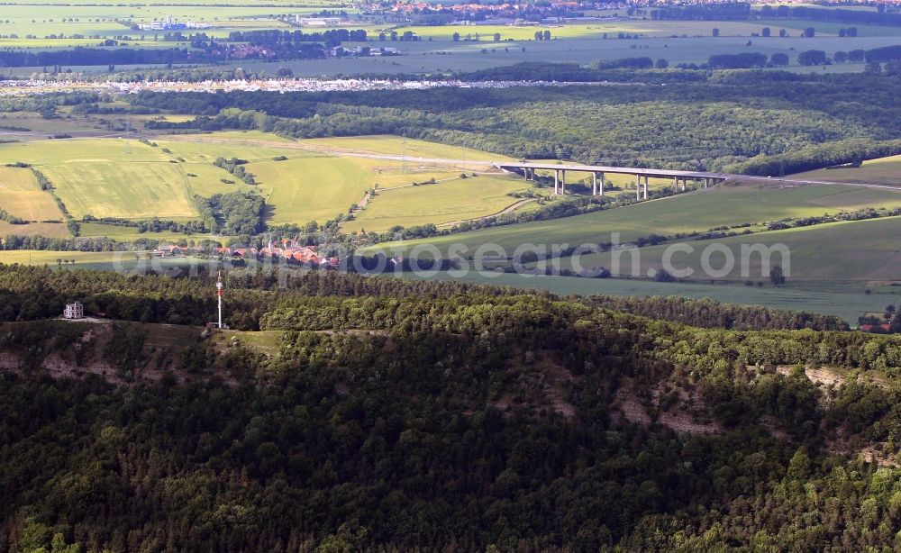
The Hoerselberg is a ridge at the southern edge of the Thuringian Basin near the town Hoerselberg-Hainich. On the Great Hoerselberg a mountain inn is a destination near a radio mast. In the background the newly created route of the motorway A4 can be seen. www.hoerselberg.info Photo: Karina Hessland
Aerial image ID: 211892
Image resolution: 3570 x 2193 pixels x 24 bit
compressed image file size: 4,63 MB
Image file size: 22,4 MB
Sources and credit: © euroluftbild.de/Karina Hessland
All information gathered here in picture and word represent a non-binding information offer to you, which was compiled from trustworthy media. Objections or correction notes please to info@euroluftbild.de - Media licenses according to MfM table!
Position: 52° 47' 36.55'' N / 7° 12' 34.7'' E