Aerial photograph 199055
The Ernst-Reuter-Platz is a major transport hub in Berlin-Charlottenburg. He is the multi-lane roundabout from the east-west road tangent of 17 June - Bismarkstraße crossed. The development of the course are high-rise buildings are counted for the post-war modernism and are partly used by the Technical University of Berlin. Is named the place after a former governing mayor of Berlin
BERLIN 27.07.2001
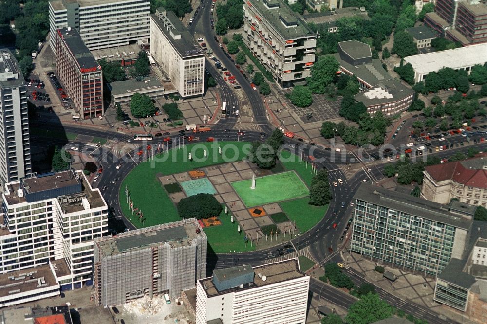
The Ernst-Reuter-Platz is a major transport hub in Berlin-Charlottenburg. He is the multi-lane roundabout from the east-west road tangent of 17 June - Bismarkstraße crossed. The development of the course are high-rise buildings are counted for the post-war modernism and are partly used by the Technical University of Berlin. Is named the place after a former governing mayor of Berlin. Photo: Henrik Pohl
Aerial image ID: 199055
Image resolution: 3757 x 2505 pixels x 24 bit
compressed image file size: 4,38 MB
Image file size: 26,93 MB
Sources and credit: © euroluftbild.de/Henrik Pohl
The recording is permitted due to the so-called freedom of panorama according to § 59 UrhG. The provision of Section 59 UrhG conforms to the directive based on Art. 5 Para. 3 Letter c of Directive 2001/29/EC of the European Parliament and of the Council of May 22, 2001 on the harmonization of certain aspects of copyright and related property rights in the information society ("InfoSoc-RL") to be interpreted. The directive-compliant interpretation shows that aerial photographs are also covered by § 59 Para. 1 UrhG and the use of tools does not lead out of the protective barrier.
Position: 52° 31' 13.43'' N / 13° 25' 2.63'' E