Aerial photograph 251983
The Berlin Westhafen is a river port in the district Moabit of the district center. It is divided into two parallel scale docks. About Westhafenkanal and Berlin-Spandau Ship Canal it is connected to the Spree and Havel and above integrated into the trans-regional waterway network between the Elbe and Oder. The Western Harbour is a significant handling and storage space for the inland waterways
BERLIN 19.09.2015
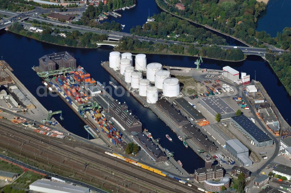
The Berlin Westhafen is a river port in the district Moabit of the district center. It is divided into two parallel scale docks. About Westhafenkanal and Berlin-Spandau Ship Canal it is connected to the Spree and Havel and above integrated into the trans-regional waterway network between the Elbe and Oder. The Western Harbour is a significant handling and storage space for the inland waterways. Photo: bsf swissphoto
Aerial image ID: 251983
Image resolution: 4288 x 2848 pixels x 24 bit
compressed image file size: 4,47 MB
Image file size: 34,94 MB
Sources and credit: © euroluftbild.de/BSF Swissphoto GmbH
The recording is permitted due to the so-called freedom of panorama according to § 59 UrhG. The provision of Section 59 UrhG conforms to the directive based on Art. 5 Para. 3 Letter c of Directive 2001/29/EC of the European Parliament and of the Council of May 22, 2001 on the harmonization of certain aspects of copyright and related property rights in the information society ("InfoSoc-RL") to be interpreted. The directive-compliant interpretation shows that aerial photographs are also covered by § 59 Para. 1 UrhG and the use of tools does not lead out of the protective barrier. www.klebba.legal
Position: 52° 32' 15.19'' N / 13° 20' 28.36'' E