Aerial image 109230
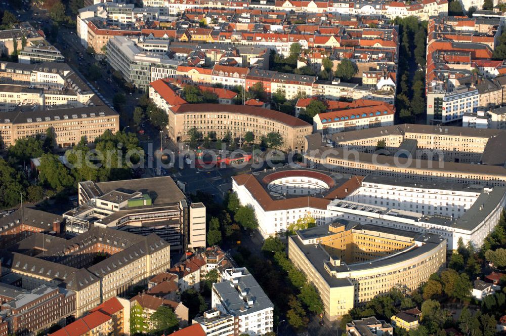
Stadtansicht auf einen Teil des Hohenzollerndamms in Berlin Charlottenburg-Wilmersdorf. Im Zentrum des Bilder liegt der Fehrbelliner Platz, der am Kreuzungspunkt des Hohenzollerndamms mit der Brandenburgischen Stra?e liegt. Im Vordergrund und in der Bildmitte sind die Verwaltungsgeb?ude zu sehen, die sich an dem Platz angesiedelt haben. Im Norden befindet sich ein Wohngebiet.
BERLIN 23.08.2009
Aerial image ID: 109230
Image resolution: 4288 x 2848 pixels x 24 bit
compressed image file size: 4,35 MB
Image file size: 34,94 MB
Sources and credit: © euroluftbild.de/Robert Grahn
The recording is permitted due to the so-called freedom of panorama according to § 59 UrhG. The provision of Section 59 UrhG conforms to the directive based on Art. 5 Para. 3 Letter c of Directive 2001/29/EC of the European Parliament and of the Council of May 22, 2001 on the harmonization of certain aspects of copyright and related property rights in the information society ("InfoSoc-RL") to be interpreted. The directive-compliant interpretation shows that aerial photographs are also covered by § 59 Para. 1 UrhG and the use of tools does not lead out of the protective barrier. www.klebba.legal