Aerial photograph 284881
Shore areas of the reinforced by flood protection dam riverbed course of Stecknitz in Lauenburg Elbe in the state Schleswig-Holstein
LAUENBURG ELBE 05.06.2016
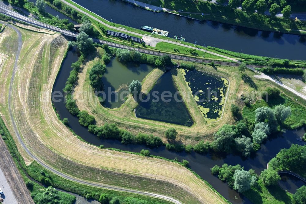
Shore areas of the reinforced by flood protection dam riverbed course of Stecknitz in Lauenburg Elbe in the state Schleswig-Holstein. Photo: Robert Grahn
Aerial image ID: 284881
Image resolution: 7360 x 4912 pixels x 24 bit
compressed image file size: 6,07 MB
Image file size: 103,43 MB
Sources and credit: © euroluftbild.de/Robert Grahn
The recording is permitted due to the so-called freedom of panorama according to § 59 UrhG. The provision of Section 59 UrhG conforms to the directive based on Art. 5 Para. 3 Letter c of Directive 2001/29/EC of the European Parliament and of the Council of May 22, 2001 on the harmonization of certain aspects of copyright and related property rights in the information society ("InfoSoc-RL") to be interpreted. The directive-compliant interpretation shows that aerial photographs are also covered by § 59 Para. 1 UrhG and the use of tools does not lead out of the protective barrier. www.klebba.legal
Position: 53° 22' 26.57'' N / 10° 34' 58.37'' E