Aerial photograph 375243
Shore areas exposed by low-water level riverbed Elz Kanal Suedbaden in Teningen in the state Baden-Wurttemberg, Germany
TENINGEN 01.08.2018
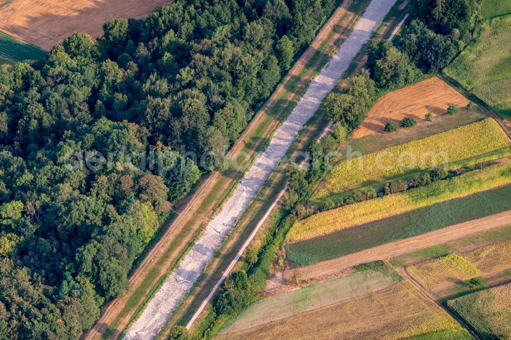
Shore areas exposed by low-water level riverbed Elz Kanal Suedbaden in Teningen in the state Baden-Wurttemberg, Germany. Photo: Martin Bildstein
Aerial image ID: 375243
Image resolution: 5454 x 3638 pixels x 24 bit
compressed image file size: 16,14 MB
Image file size: 56,77 MB
Sources and credit: © euroluftbild.de/Martin Bildstein
The recording is permitted due to the so-called freedom of panorama according to § 59 UrhG. The provision of Section 59 UrhG conforms to the directive based on Art. 5 Para. 3 Letter c of Directive 2001/29/EC of the European Parliament and of the Council of May 22, 2001 on the harmonization of certain aspects of copyright and related property rights in the information society ("InfoSoc-RL") to be interpreted. The directive-compliant interpretation shows that aerial photographs are also covered by § 59 Para. 1 UrhG and the use of tools does not lead out of the protective barrier. www.klebba.legal
Position: 48° 8' 25.35'' N / 7° 46' 44.96'' E