Aerial image 389700
Shore areas exposed by low-water level riverbed of " Alte Elbe " in the district Werder in Magdeburg in the state Saxony-Anhalt, Germany
MAGDEBURG 05.10.2018
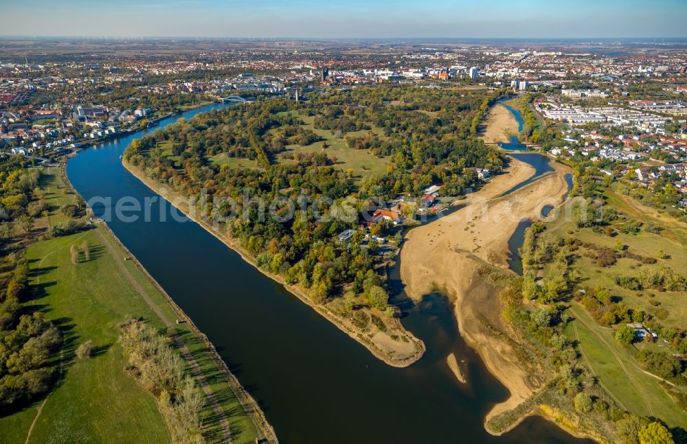
Shore areas exposed by low-water level riverbed of " Alte Elbe " in the district Werder in Magdeburg in the state Saxony-Anhalt, Germany. Further information at: WSNBA Wasserstrassen-Neubauamt Magdeburg, Wasser- und Schiffahrtsdirektion Ost. www.wsv.bund.de / www.wna-magdeburg.wsv.de Photo: Hans Blossey
Aerial image ID: 389700
Image resolution: 6720 x 4355 pixels x 24 bit
compressed image file size: 12,43 MB
Image file size: 83,73 MB
Sources and credit: © euroluftbild.de/Hans Blossey
The recording is permitted due to the so-called freedom of panorama according to § 59 UrhG. The provision of Section 59 UrhG conforms to the directive based on Art. 5 Para. 3 Letter c of Directive 2001/29/EC of the European Parliament and of the Council of May 22, 2001 on the harmonization of certain aspects of copyright and related property rights in the information society ("InfoSoc-RL") to be interpreted. The directive-compliant interpretation shows that aerial photographs are also covered by § 59 Para. 1 UrhG and the use of tools does not lead out of the protective barrier. www.klebba.legal
Position: 52° 6' 41.88'' N / 11° 39' 27.74'' E