Aerial photograph 652087
Route and lanes along the motorway bridge structure of the BAB A17 "Seifelwitztal motorway bridge" on the road S176 in Bahretal in the federal state of Saxony, Germany
BAHRETAL 01.10.2021
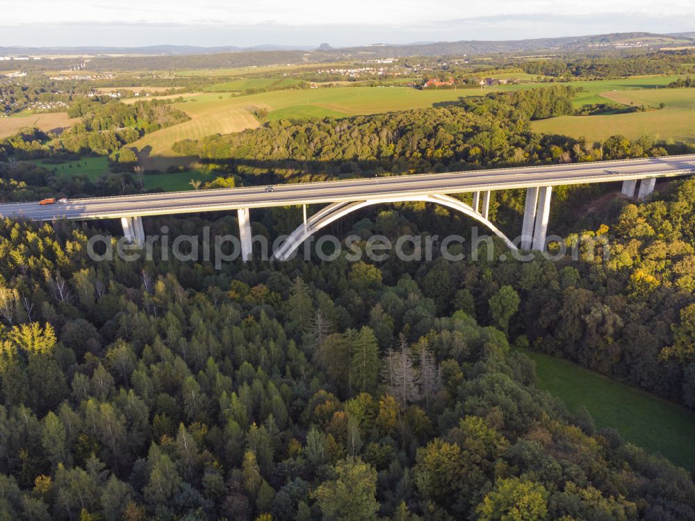
Route and lanes along the motorway bridge structure of the BAB A17 "Seifelwitztal motorway bridge" on the road S176 in Bahretal in the federal state of Saxony, Germany. Further information at: Autobahn GmbH des Bundes. www.autobahn.de Photo: Max Gaertner
Aerial image ID: 652087
Image resolution: 4000 x 3000 pixels x 24 bit
compressed image file size: 8,55 MB
Image file size: 34,33 MB
Sources and credit: © euroluftbild.de/Max Gaertner
The recording is permitted due to the so-called freedom of panorama according to § 59 UrhG. The provision of Section 59 UrhG conforms to the directive based on Art. 5 Para. 3 Letter c of Directive 2001/29/EC of the European Parliament and of the Council of May 22, 2001 on the harmonization of certain aspects of copyright and related property rights in the information society ("InfoSoc-RL") to be interpreted. The directive-compliant interpretation shows that aerial photographs are also covered by § 59 Para. 1 UrhG and the use of tools does not lead out of the protective barrier. www.klebba.legal
Position: 50° 55' 24.36'' N / 13° 53' 28.79'' E