Aerial photograph 418749
Route expansion station - Warschauer road to east cross rail station in Friedrichshain district of Berlin
BERLIN 03.06.2019
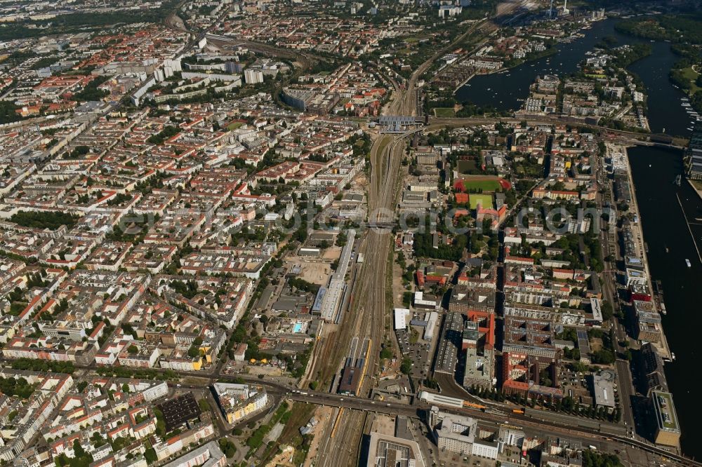
Route expansion station - Warschauer road to east cross rail station in Friedrichshain district of Berlin. Further information at: DB InfraGO AG, GBPA?Architekten GmbH, Hentschke Bau GmbH, Voessing Ingenieurgesellschaft mbH. www.bahn.de / www.voessing.de / www.hochtief.de / www.hochtief-solutions.de / www.hochtief-projektentwicklung.de / www.hentschke-bau.de / www.voessing.com / www.rrx.de Photo: Robert Grahn
Aerial image ID: 418749
Image resolution: 7029 x 4686 pixels x 24 bit
compressed image file size: 5,84 MB
Image file size: 94,24 MB
Sources and credit: © euroluftbild.de/Robert Grahn
The recording is permitted due to the so-called freedom of panorama according to § 59 UrhG. The provision of Section 59 UrhG conforms to the directive based on Art. 5 Para. 3 Letter c of Directive 2001/29/EC of the European Parliament and of the Council of May 22, 2001 on the harmonization of certain aspects of copyright and related property rights in the information society ("InfoSoc-RL") to be interpreted. The directive-compliant interpretation shows that aerial photographs are also covered by § 59 Para. 1 UrhG and the use of tools does not lead out of the protective barrier. www.klebba.legal
Position: 52° 30' 23.01'' N / 13° 26' 59.41'' E