Aerial photograph 490129
Riparian zones on the course of the river of Wilhelmsburger Dove-Elbe in the residential area at Schoenenfelder Strasse - Niedergeorgswerder Deich in the district Wilhelmsburg in Hamburg, Germany
HAMBURG 23.04.2020
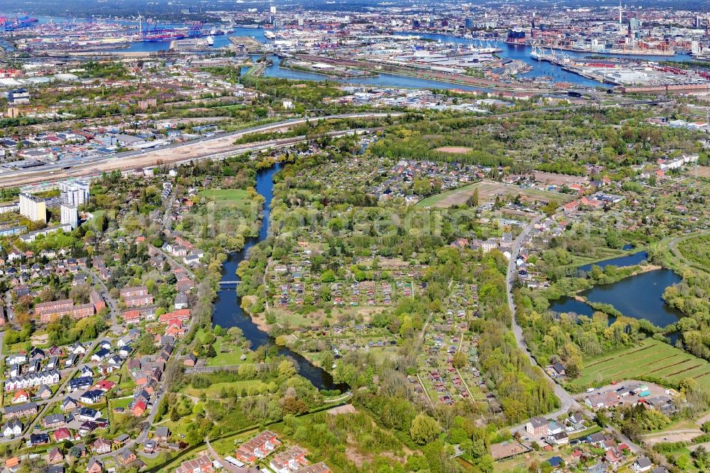
Riparian zones on the course of the river of Wilhelmsburger Dove-Elbe in the residential area at Schoenenfelder Strasse - Niedergeorgswerder Deich in the district Wilhelmsburg in Hamburg, Germany. Photo: Martin Elsen
Aerial image ID: 490129
Image resolution: 7406 x 4938 pixels x 24 bit
compressed image file size: 15,29 MB
Image file size: 104,63 MB
Sources and credit: © euroluftbild.de/Martin Elsen
The recording is permitted due to the so-called freedom of panorama according to § 59 UrhG. The provision of Section 59 UrhG conforms to the directive based on Art. 5 Para. 3 Letter c of Directive 2001/29/EC of the European Parliament and of the Council of May 22, 2001 on the harmonization of certain aspects of copyright and related property rights in the information society ("InfoSoc-RL") to be interpreted. The directive-compliant interpretation shows that aerial photographs are also covered by § 59 Para. 1 UrhG and the use of tools does not lead out of the protective barrier. www.klebba.legal
Position: 53° 30' 13.21'' N / 10° 1' 12.55'' E