Aerial photograph 219859
Low mountain range Kaiserstuhl and Totenkopf (Skull) mountain in Vogtsburg in the state of Baden-Wuerttemberg. The landscape of the mountain range in this region is characterised by terrace-like vineyards and mountain tops covered in mixed forest around which villages and fields are grouped. The foreground shows the village of Kiechlinsbergen, Totenkopf mountain - the highest mountain of the mountain range - is located in the background
VOGTSBURG IM KAISERSTUHL 25.07.2007
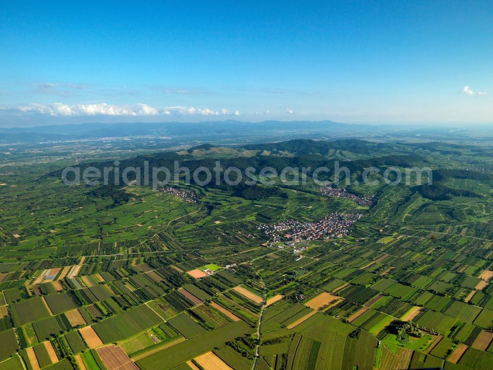
Low mountain range Kaiserstuhl and Totenkopf (Skull) mountain in Vogtsburg in the state of Baden-Wuerttemberg. The landscape of the mountain range in this region is characterised by terrace-like vineyards and mountain tops covered in mixed forest around which villages and fields are grouped. The foreground shows the village of Kiechlinsbergen, Totenkopf mountain - the highest mountain of the mountain range - is located in the background. Photo: Gerhard Launer
Aerial image ID: 219859
Image resolution: 7216 x 5412 pixels x 24 bit
compressed image file size: 19,92 MB
Image file size: 111,73 MB
Sources and credit: © euroluftbild.de/Gerhard Launer
The recording is permitted due to the so-called freedom of panorama according to § 59 UrhG. The provision of Section 59 UrhG conforms to the directive based on Art. 5 Para. 3 Letter c of Directive 2001/29/EC of the European Parliament and of the Council of May 22, 2001 on the harmonization of certain aspects of copyright and related property rights in the information society ("InfoSoc-RL") to be interpreted. The directive-compliant interpretation shows that aerial photographs are also covered by § 59 Para. 1 UrhG and the use of tools does not lead out of the protective barrier. www.klebba.legal
Position: 48° 6' 54.81'' N / 7° 40' 57.11'' E