Aerial photograph 187985
Level - the course of decline of the Donau after the flood 2013 in Straubing in Bavaria
STRAUBING 19.06.2013
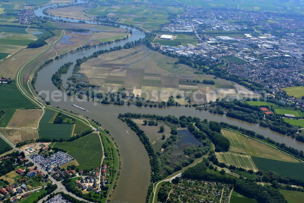
Level - the course of decline of the Donau after the flood 2013 in Straubing in Bavaria. Photo: Elmar Hartmann
Aerial image ID: 187985
Image resolution: 3872 x 2592 pixels x 24 bit
compressed image file size: 3,83 MB
Image file size: 28,71 MB
Sources and credit: © euroluftbild.de/Elmar Hartmann
The recording is permitted due to the so-called freedom of panorama according to § 59 UrhG. The provision of Section 59 UrhG conforms to the directive based on Art. 5 Para. 3 Letter c of Directive 2001/29/EC of the European Parliament and of the Council of May 22, 2001 on the harmonization of certain aspects of copyright and related property rights in the information society ("InfoSoc-RL") to be interpreted. The directive-compliant interpretation shows that aerial photographs are also covered by § 59 Para. 1 UrhG and the use of tools does not lead out of the protective barrier. www.klebba.legal