Aerial photograph 253313
Highway congestion along the route of the lanes auf der bridge A43 und A40 Ruhr expressway in Bochum in the state North Rhine-Westphalia
BOCHUM 10.09.2015
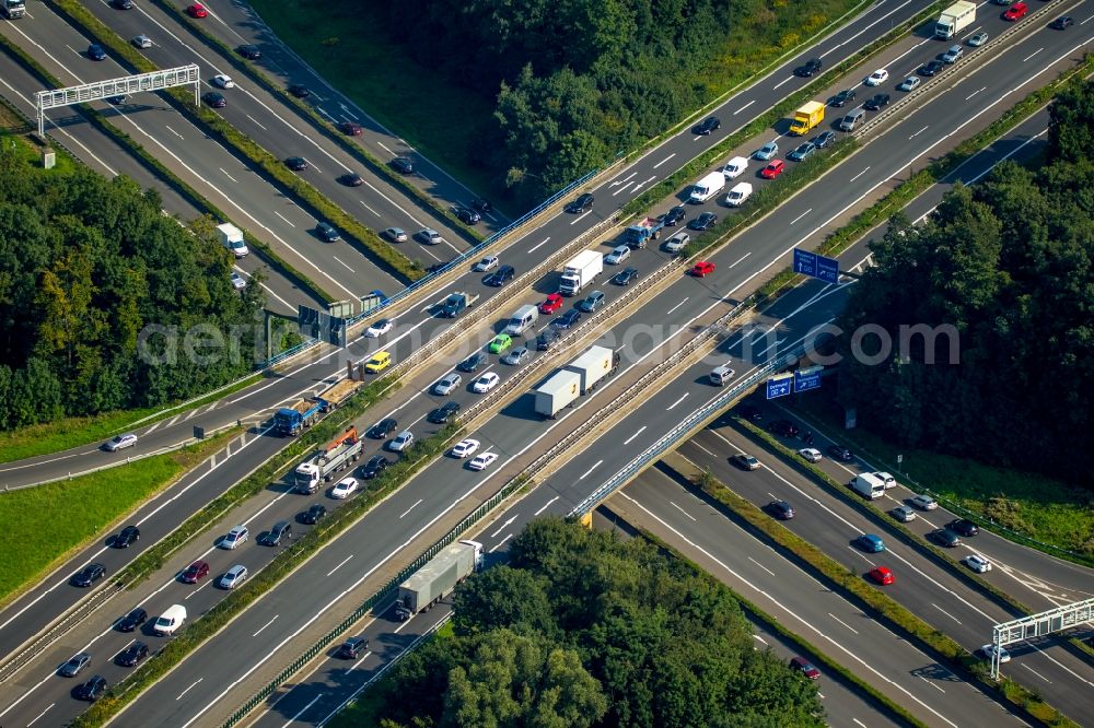
Highway congestion along the route of the lanes auf der bridge A43 und A40 Ruhr expressway in Bochum in the state North Rhine-Westphalia. Photo: Hans Blossey
Aerial image ID: 253313
Image resolution: 5760 x 3840 pixels x 24 bit
compressed image file size: 10,49 MB
Image file size: 63,28 MB
Sources and credit: © euroluftbild.de/Hans Blossey
The recording is permitted due to the so-called freedom of panorama according to § 59 UrhG. The provision of Section 59 UrhG conforms to the directive based on Art. 5 Para. 3 Letter c of Directive 2001/29/EC of the European Parliament and of the Council of May 22, 2001 on the harmonization of certain aspects of copyright and related property rights in the information society ("InfoSoc-RL") to be interpreted. The directive-compliant interpretation shows that aerial photographs are also covered by § 59 Para. 1 UrhG and the use of tools does not lead out of the protective barrier. www.klebba.legal
Position: 51° 28' 40.19'' N / 7° 16' 49.4'' E