Aerial photograph 149067
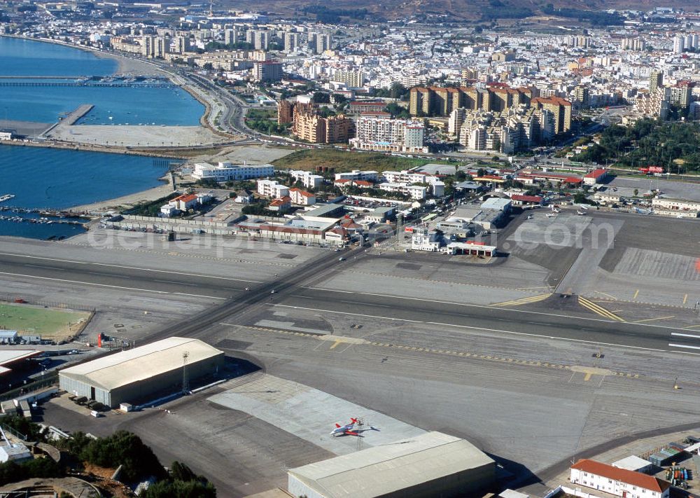
Gribraltar ist ein britisches Überseegebiet an der Iberischen Halbinsel. Die Stadt liegt direkt an der Meerenge Straße von Gibraltar, welche die dichteste Stelle von Europa und Afrika darstellt. Die Verbindungsstraße zwischen Spanien und Gibraltar führt direkt über die Landebahn des Flughafens. Für startende bzw. landende Flugzeuge wird die Straße temporär gesperrt. Gibraltar is a British overseas territory in the Iberian Peninsula. The city is located on the strait of Gibraltar, which is the closest point of Europe and Africa. The communication road between Spain and Gibraltar leads directly on the airport. For taking off and landing aircraft, the road will be temporarily blocked.
GIBRALTAR 10.07.2001
www.gibraltar.com / Photo: Bernd Clemens
Aerial image ID: 149067
Image resolution: 3413 x 2428 pixels x 24 bit
compressed image file size: 3,67 MB
Image file size: 23,71 MB
Sources and credit: © euroluftbild.de/Bernd Clemens
The recording is permitted due to the so-called freedom of panorama according to § 59 UrhG. The provision of Section 59 UrhG conforms to the directive based on Art. 5 Para. 3 Letter c of Directive 2001/29/EC of the European Parliament and of the Council of May 22, 2001 on the harmonization of certain aspects of copyright and related property rights in the information society ("InfoSoc-RL") to be interpreted. The directive-compliant interpretation shows that aerial photographs are also covered by § 59 Para. 1 UrhG and the use of tools does not lead out of the protective barrier. www.klebba.legal