Aerial image 52558
01.09.2005 Friedersdorf (Sachsen-Anhalt)
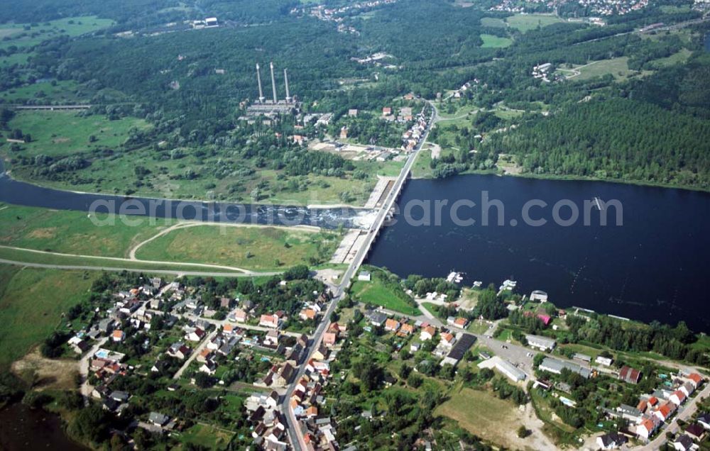
Blick auf den Muldestausee bei Friedersdorf nordöstlich von Bitterfeld, der aus dem ehemaligen Braunkohletagebau Muldenstein entstand. Nachdem leitete man die Mulde auf einer Länge von ca. 8 km zum ehemaligen Tagebau um.
FRIEDERSDORF (SACHSEN-ANHALT) 01.09.2005
Aerial image ID: 52558
Image resolution: 5364 x 3414 pixels x 24 bit
compressed image file size: 1,67 MB
Image file size: 52,39 MB
Sources and credit: © euroluftbild.de/Robert Grahn
The recording is permitted due to the so-called freedom of panorama according to § 59 UrhG. The provision of Section 59 UrhG conforms to the directive based on Art. 5 Para. 3 Letter c of Directive 2001/29/EC of the European Parliament and of the Council of May 22, 2001 on the harmonization of certain aspects of copyright and related property rights in the information society ("InfoSoc-RL") to be interpreted. The directive-compliant interpretation shows that aerial photographs are also covered by § 59 Para. 1 UrhG and the use of tools does not lead out of the protective barrier. www.klebba.legal