Aerial photograph 56661
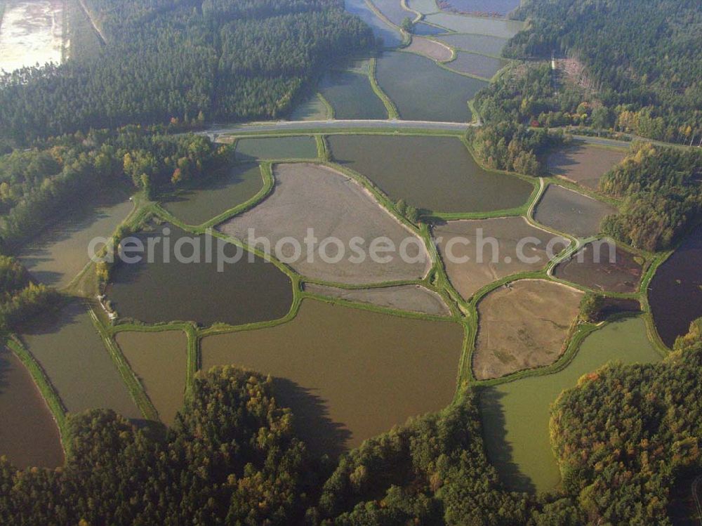
Die Tirschenreuther Teichpfanne. Seit dem 12. Jahrhundert prägen Teiche die Landschaft im Landkreis Tirschenreuth. Heute verteilen sich mehr als 3500 Teiche, mit einer Wasserfläche von etwa 2000 ha, auf der Fläche des Landkreises. Damit liegt das bundesweit größte und bedeutenste Teichgebiet in der Oberpfalz.
TIRSCHENREUTH 12.10.2005
Aerial image ID: 56661
Image resolution: 3264 x 2448 pixels x 24 bit
compressed image file size: 1,95 MB
Image file size: 22,86 MB
Sources and credit: © euroluftbild.de/Robert Grahn
The recording is permitted due to the so-called freedom of panorama according to § 59 UrhG. The provision of Section 59 UrhG conforms to the directive based on Art. 5 Para. 3 Letter c of Directive 2001/29/EC of the European Parliament and of the Council of May 22, 2001 on the harmonization of certain aspects of copyright and related property rights in the information society ("InfoSoc-RL") to be interpreted. The directive-compliant interpretation shows that aerial photographs are also covered by § 59 Para. 1 UrhG and the use of tools does not lead out of the protective barrier. www.klebba.legal