Aerial image 81986
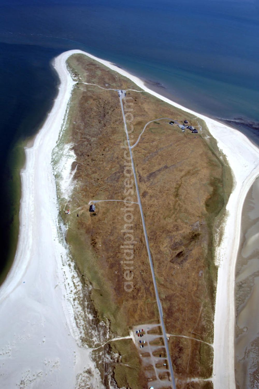
Der Ellenbogen, der als 330 bis 1200 Meter schmale und langgestreckte Halbinsel in die Nordsee ragt, befindet sich nördlich von List, der nördlichsten Ortschaft in Deutschland. Über eine Privatstraße, die als Sackgasse am 27,9 m hohen Ellenbogenberg beginnt, kann man gegen Zahlung einer Maut für motorisierte Fahrzeugen und Radfahrer bis zum Parkplatz östlich des Leuchtturms List Ost auf dem Ostellenbogen vordringen, um von dort die Ellenbogenspitze („Alembögspünt“) zu erreichen.
INSEL SYLT 26.06.2008
Aerial image ID: 81986
Image resolution: 2848 x 4288 pixels x 24 bit
compressed image file size: 2,41 MB
Image file size: 34,94 MB
Sources and credit: © euroluftbild.de/Robert Grahn
The recording is permitted due to the so-called freedom of panorama according to § 59 UrhG. The provision of Section 59 UrhG conforms to the directive based on Art. 5 Para. 3 Letter c of Directive 2001/29/EC of the European Parliament and of the Council of May 22, 2001 on the harmonization of certain aspects of copyright and related property rights in the information society ("InfoSoc-RL") to be interpreted. The directive-compliant interpretation shows that aerial photographs are also covered by § 59 Para. 1 UrhG and the use of tools does not lead out of the protective barrier. www.klebba.legal