Aerial photograph 133909
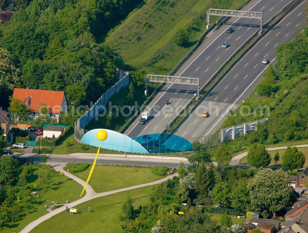
Das mit Wohnhäusern und einer Grünanlage überbaute ehemalige Gelände der Zeche "Graf Bismarck" am Autobahn-Deckel an den Straßen E 34, Cranger Straße, Kronprinzenstraße und Frankampstraße in Gelsenkirchen in Nordrhein-Westfalen. The former coal mine arrea "Graf Bismarck" at the autobahn canopy at the streets E 34, Cranger Strasse, Kronprinzenstrasse und Frankampstrasse in Gelsenkirchen in North Rhine-Westphalia.
GELSENKIRCHEN 22.05.2010
www.schachtzeichen.de Photo: Hans Blossey
Aerial image ID: 133909
Image resolution: 4518 x 3431 pixels x 24 bit
compressed image file size: 7,14 MB
Image file size: 44,35 MB
Sources and credit: © euroluftbild.de/Hans Blossey
The recording is permitted due to the so-called freedom of panorama according to § 59 UrhG. The provision of Section 59 UrhG conforms to the directive based on Art. 5 Para. 3 Letter c of Directive 2001/29/EC of the European Parliament and of the Council of May 22, 2001 on the harmonization of certain aspects of copyright and related property rights in the information society ("InfoSoc-RL") to be interpreted. The directive-compliant interpretation shows that aerial photographs are also covered by § 59 Para. 1 UrhG and the use of tools does not lead out of the protective barrier. www.klebba.legal