Aerial image 73046
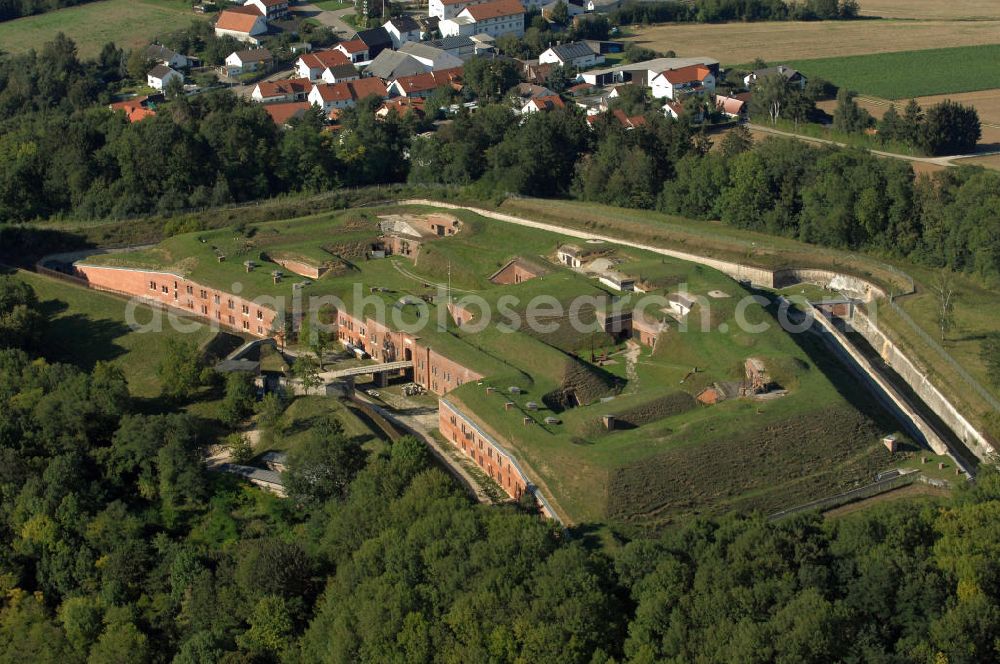
Das Fort Prinz Karl liegt ca. 10 km östlich von Ingolstadt an der ehemaligen Fort- und Kriegsstrase im
Gemeindebereich Großmehring, Ortsteil Katharinenberg. Die Festung steht heute unter Denkmalschutz.
KATHARINENBERG 24.08.2007
Aerial image ID: 73046
Image resolution: 4288 x 2848 pixels x 24 bit
compressed image file size: 3,48 MB
Image file size: 34,94 MB
Sources and credit: © euroluftbild.de/Robert Grahn
The recording is permitted due to the so-called freedom of panorama according to § 59 UrhG. The provision of Section 59 UrhG conforms to the directive based on Art. 5 Para. 3 Letter c of Directive 2001/29/EC of the European Parliament and of the Council of May 22, 2001 on the harmonization of certain aspects of copyright and related property rights in the information society ("InfoSoc-RL") to be interpreted. The directive-compliant interpretation shows that aerial photographs are also covered by § 59 Para. 1 UrhG and the use of tools does not lead out of the protective barrier. www.klebba.legal