Aerial photograph 179385
Construction and widening of the route of the highway / motorway BAB A12 Berliner Ring in Brandenburg. The picture shows the junction Spreeau
FRIEDRICHSHOF 04.05.2013
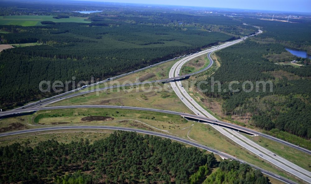
Construction and widening of the route of the highway / motorway BAB A12 Berliner Ring in Brandenburg. The picture shows the junction Spreeau. www.ls.brandenburg.de
Aerial image ID: 179385
Image resolution: 7360 x 4384 pixels x 24 bit
compressed image file size: 7,2 MB
Image file size: 92,31 MB
Sources and credit: © euroluftbild.de/Robert Grahn
The recording is permitted due to the so-called freedom of panorama according to § 59 UrhG. The provision of Section 59 UrhG conforms to the directive based on Art. 5 Para. 3 Letter c of Directive 2001/29/EC of the European Parliament and of the Council of May 22, 2001 on the harmonization of certain aspects of copyright and related property rights in the information society ("InfoSoc-RL") to be interpreted. The directive-compliant interpretation shows that aerial photographs are also covered by § 59 Para. 1 UrhG and the use of tools does not lead out of the protective barrier. www.klebba.legal
Position: 52° 19' 42.05'' N / 13° 44' 54.98'' E