Aerial photograph 617891
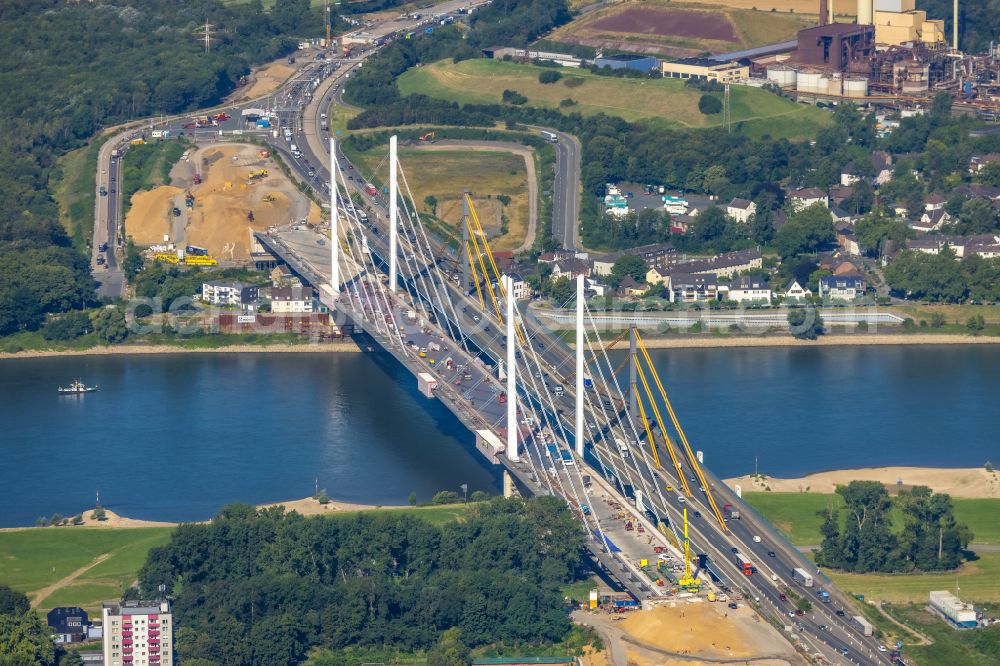
Construction site for the rehabilitation and repair of the motorway bridge construction " Rheinbruecke Duisburg-Neuenkamp " in the district Kasslerfeld in Duisburg at Ruhrgebiet in the state North Rhine-Westphalia, Germany
DUISBURG 11.07.2023

Construction site for the rehabilitation and repair of the motorway bridge construction " Rheinbruecke Duisburg-Neuenkamp " in the district Kasslerfeld in Duisburg at Ruhrgebiet in the state North Rhine-Westphalia, Germany. Further information at: Autobahn GmbH des Bundes, DEGES Deutsche Einheit Fernstrassenplanungs- und -bau GmbH, Die Autobahn GmbH des Bundes Niederlassung Westfalen, Felbermayr Holding GmbH, HOCHTIEF Infrastructure GmbH, KEIPKE ARCHITEKTEN BDA, Kocks Consult GmbH, LAP Leonhardt, Andrae und Partner Beratende Ingenieure VBI AG, Landesbetrieb Strassenbau Nordrhein-Westfalen, Plauen Stahl Technologie GmbH, ZSB Zwickauer Sonderstahlbau GmbH, Autobahn GmbH Niederlassung Suedbayern, DEGES Deutsche Einheit Fernstrassenplanungs- und -bau GmbH, Autobahn GmbH des Bundes - Niederlassung Nordost, Autobahn GmbH des Bundes - Niederlassung Suedwest, Autobahn GmbH des Bundes Niederlassung Nord, Autobahn GmbH des Bundes Niederlassung Westfalen, Landesbetrieb Strassenbau Nordrhein-Westfalen. www.strassen.nrw.de / www.deges.de / www.architekt-keipke.de / www.lap-consult.com / www.kocks-ing.de / www.hochtief-infrastructure.de / www.plauen-stahl.de / www.zsb-sonderstahlbau.de / www.felbermayr.cc / www.autobahn.de Photo: Hans Blossey
Aerial image ID: 617891
Image resolution: 8760 x 5843 pixels x 24 bit
compressed image file size: 17,59 MB
Image file size: 146,44 MB
Sources and credit: © euroluftbild.de/Hans Blossey
The recording is permitted due to the so-called freedom of panorama according to § 59 UrhG. The provision of Section 59 UrhG conforms to the directive based on Art. 5 Para. 3 Letter c of Directive 2001/29/EC of the European Parliament and of the Council of May 22, 2001 on the harmonization of certain aspects of copyright and related property rights in the information society ("InfoSoc-RL") to be interpreted. The directive-compliant interpretation shows that aerial photographs are also covered by § 59 Para. 1 UrhG and the use of tools does not lead out of the protective barrier. www.klebba.legal
Position: 51° 26' 17.15'' N / 6° 42' 53.74'' E
