Aerial photograph 119379
Blick auf den Stadtteil Duisburg-Ruhrort bei Hochwasser. Das Hochwasser aus dem Alpenraum erreicht über den Rhein Nordrhein-Westfalen. Auf dem Bild ist deutlich zu erkennen wie sich das braune Rheinwasser an der Mündung der Ruhr bei Duisburg-Ruhrort mit dem sauberen Ruhrwasser mischt. View of the district of Duisburg-Ruhrort at high tide. The flood water from the Alps reached the Rhine of North Rhine-Westphalia. In the picture it is clearly visible how the brown water is mixed at the mouth of the Rhine at Duisburg-Ruhrort with the clean water of the Ruhr.
DUISBURG 20.09.2005
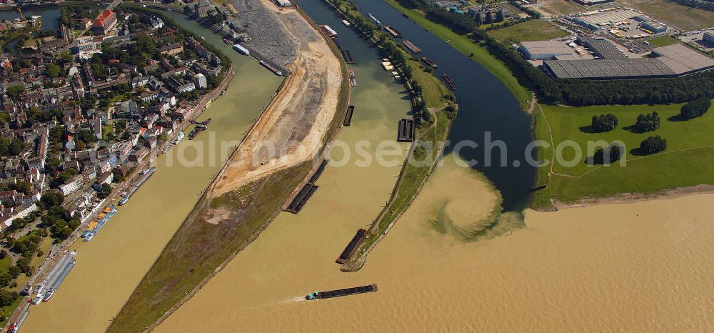
Photo: Hans Blossey
Aerial image ID: 119379
Image resolution: 3992 x 1866 pixels x 24 bit
compressed image file size: 3,76 MB
Image file size: 21,31 MB
Sources and credit: © euroluftbild.de/Hans Blossey
The recording is permitted due to the so-called freedom of panorama according to § 59 UrhG. The provision of Section 59 UrhG conforms to the directive based on Art. 5 Para. 3 Letter c of Directive 2001/29/EC of the European Parliament and of the Council of May 22, 2001 on the harmonization of certain aspects of copyright and related property rights in the information society ("InfoSoc-RL") to be interpreted. The directive-compliant interpretation shows that aerial photographs are also covered by § 59 Para. 1 UrhG and the use of tools does not lead out of the protective barrier. www.klebba.legal