Aerial photograph 111873
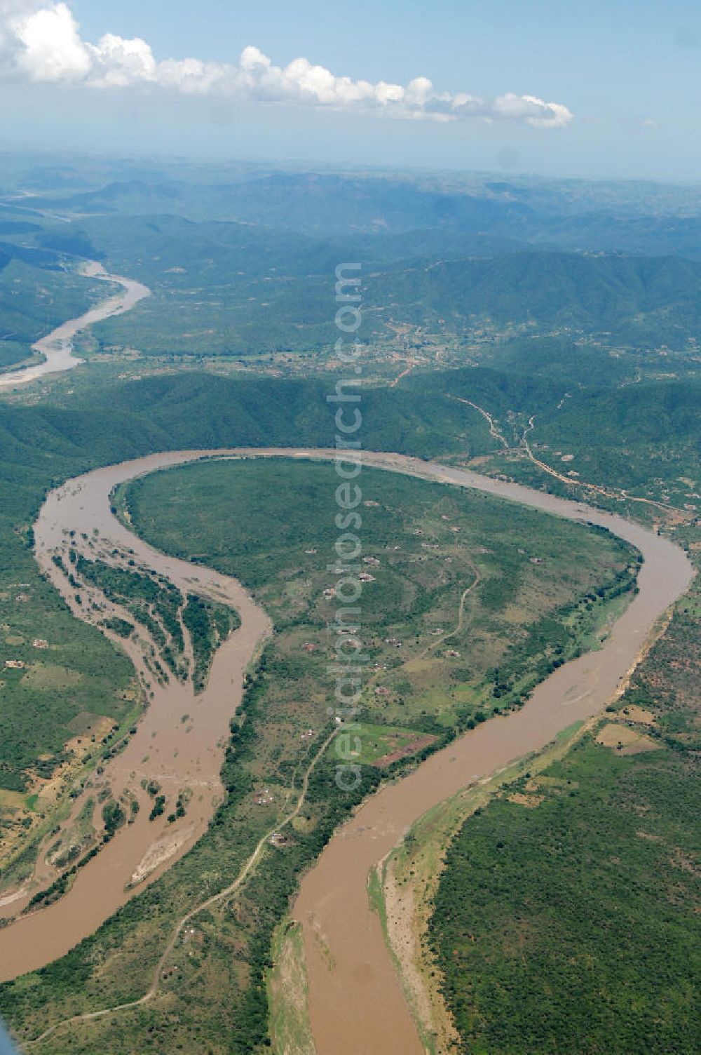
Blick auf die Schleife des Tugela Fluss, er spielte im Laufe der Geschichte Südafrikas eine wichtige Rolle als Grenzfluss zwischen der Kolonie Natal und dem unabhängigen Königreich der Zulus im Nordosten. Der Tugela ist mit 405 km Länge der längste Fluss in der Provinz KwaZulu-Natal, Republik Südafrika. View of the loop of the Tugela River.
KWAZULU-NATAL 15.02.2010
Aerial image ID: 111873
Image resolution: 2848 x 4288 pixels x 24 bit
compressed image file size: 3,48 MB
Image file size: 34,94 MB
Sources and credit: © euroluftbild.de/Robert Grahn
The recording is permitted due to the so-called freedom of panorama according to § 59 UrhG. The provision of Section 59 UrhG conforms to the directive based on Art. 5 Para. 3 Letter c of Directive 2001/29/EC of the European Parliament and of the Council of May 22, 2001 on the harmonization of certain aspects of copyright and related property rights in the information society ("InfoSoc-RL") to be interpreted. The directive-compliant interpretation shows that aerial photographs are also covered by § 59 Para. 1 UrhG and the use of tools does not lead out of the protective barrier. www.klebba.legal