Aerial photograph 125629
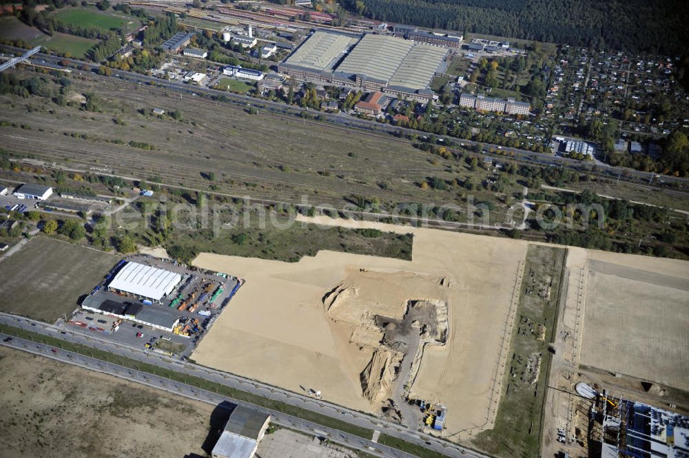
Blick auf eine Planfläche im Gewerbegebiet Flugplatz Johannisthal am Groß-Berliner Damm. Das Gelände dient heute als Baufläche für Einfamilienhäuser und als Gewerbegebiet. Des weiteren befindet sich heute auf dem Gelände unter an derem der Aerodynamische Park als Teil des Campus der Humboldt-Universität zu Berlin. Der Name des Platzes weist auf den besonderen Charakter und die historische wie architektonische Bedeutung durch die prägnanten und dominierenden Baudenkmale der ehemaligen Deutschen Versuchsanstalt für Luftfahrt e.V. hin. Das mittlerweile entstandene grüne Biotop auf der Fläche der ehemaligen Start- und Landebahn ist in eine Parklandschaft integriert worden, dem Europapark, der nach einem Wettbewerb seit den späten 1990er Jahren hier entsteht. View onto the construction site at the industrial area at the former airport Johannisthal. Today the area serves as ab building area and as an industrial area.
BERLIN 13.10.2010

Aerial image ID: 125629
Image resolution: 4256 x 2832 pixels x 24 bit
compressed image file size: 3,01 MB
Image file size: 34,48 MB
Sources and credit: © euroluftbild.de/Robert Grahn
The recording is permitted due to the so-called freedom of panorama according to § 59 UrhG. The provision of Section 59 UrhG conforms to the directive based on Art. 5 Para. 3 Letter c of Directive 2001/29/EC of the European Parliament and of the Council of May 22, 2001 on the harmonization of certain aspects of copyright and related property rights in the information society ("InfoSoc-RL") to be interpreted. The directive-compliant interpretation shows that aerial photographs are also covered by § 59 Para. 1 UrhG and the use of tools does not lead out of the protective barrier. www.klebba.legal
