Aerial photograph 120173
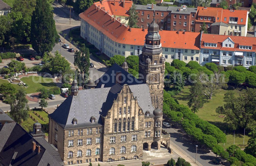
Blick auf das neobarocke Rathaus in der August-Bebel-Straße in Wittenberge. Es wurde von 1912 bis 1914 nach den Entwürfen des Stadtbaurats Friede Everhard Bruns errichtet. Der Turm hat eine Höhe von 51 m, der zudem eine Aussichtsplattform besitzt. View of the neo-baroque town hall in the August-Bebel-Strasse in Wittenberge. It was built between 1912 and 1914 after plans by the head of the municipal planning and building control office Friede Everhard Bruns. The tower has a height of 51 m, which also has a viewing platform.
WITTENBERG 05.06.2010
Aerial image ID: 120173
Image resolution: 3964 x 2575 pixels x 24 bit
compressed image file size: 3,78 MB
Image file size: 29,2 MB
Sources and credit: © euroluftbild.de/Robert Grahn
The recording is permitted due to the so-called freedom of panorama according to § 59 UrhG. The provision of Section 59 UrhG conforms to the directive based on Art. 5 Para. 3 Letter c of Directive 2001/29/EC of the European Parliament and of the Council of May 22, 2001 on the harmonization of certain aspects of copyright and related property rights in the information society ("InfoSoc-RL") to be interpreted. The directive-compliant interpretation shows that aerial photographs are also covered by § 59 Para. 1 UrhG and the use of tools does not lead out of the protective barrier. www.klebba.legal