Aerial Photo Database
Fulltext
  • Fulltext
  • Place

Search for place, image id, term(s)

Only search for place

Aerial photograph 121419
Blick auf den Knappensee bei Knappenrode südlich von Hoyerswerda. Der See ist ein Tagebaurestloch, das 1951 durch die Flutung des Braunkohletagebaus Grube Werminghoff entstand und als Hochwasserschutz, Naturschutz, Wassersportgebiet und zur Freizeiterholung genutzt wird. View of the Knappensee at Knappenrode south of Hoyerswerda. The lake is an opencast mine created in 1951 by the flooding of the lignite open pit mine Werminghoff and is used as flood control, conservation, water sports and recreation area.

KNAPPENRODE 13.06.1979
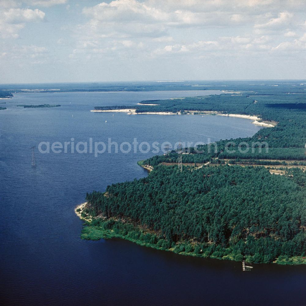
Knappenrode from the bird's eye view: Blick auf den Knappensee bei Knappenrode südlich von Hoyerswerda. Der See ist ein Tagebaurestloch, das 1951 durch die Flutung des Braunkohletagebaus Grube Werminghoff entstand und als Hochwasserschutz, Naturschutz, Wassersportgebiet und zur Freizeiterholung genutzt wird. View of the Knappensee at Knappenrode south of Hoyerswerda. The lake is an opencast mine created in 1951 by the flooding of the lignite open pit mine Werminghoff and is used as flood control, conservation, water sports and recreation area.
https://www.aerialphotosearch.com/info/aerial-photos/blick-knappensee-bei-knappenrode-sdlich-hoyerswerda-see-ist-tagebaurestloch-durch-flutung-braunkohletagebaus-grube-werminghoff-entstand-als-hochwasserschutz-naturschutz-wassersportgebiet-zur-freizeiterholung-genutzt-wird-view-knappensee-knappenrode-south-hoyerswerda-lake-opencast-mine-created-flooding-lignite-open-pit-mine-werminghoff-used-flood-control-conservation-water-sports-recreation-area-121419.html https://www.aerialphotosearch.com/info/aerial-photos/blick-knappensee-bei-knappenrode-sdlich-hoyerswerda-see-ist-tagebaurestloch-durch-flutung-braunkohletagebaus-grube-werminghoff-entstand-als-hochwasserschutz-naturschutz-wassersportgebiet-zur-freizeiterholung-genutzt-wird-view-knappensee-knappenrode-south-hoyerswerda-lake-opencast-mine-created-flooding-lignite-open-pit-mine-werminghoff-used-flood-control-conservation-water-sports-recreation-area-121419.html

Photo: Willmann

Aerial image ID: 121419
Image resolution: 8307 x 8307 pixels x 24 bit
compressed image file size: 20,37 MB
Image file size: 197,43 MB
Sources and credit: © euroluftbild.de/Lothar Willmann

All information gathered here in picture and word represent a non-binding information offer to you, which was compiled from trustworthy media. Objections or correction notes please to info@euroluftbild.de - Media licenses according to MfM table!

Keywords