Aerial photograph 131869
Blick auf das Hochwasser der Elbe mit den Überflutungsgebieten am Stadtrand bei Wittenberg in der späten Abenddämmerung in Ost / West - Richtung.
WITTENBERG 16.01.2011
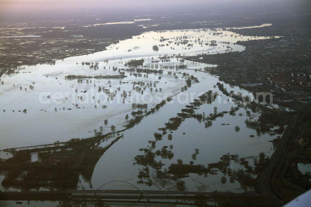
Photo: Bernd Clemens
Aerial image ID: 131869
Image resolution: 4272 x 2848 pixels x 24 bit
compressed image file size: 2,92 MB
Image file size: 34,81 MB
Sources and credit: © euroluftbild.de/Bernd Clemens
The recording is permitted due to the so-called freedom of panorama according to § 59 UrhG. The provision of Section 59 UrhG conforms to the directive based on Art. 5 Para. 3 Letter c of Directive 2001/29/EC of the European Parliament and of the Council of May 22, 2001 on the harmonization of certain aspects of copyright and related property rights in the information society ("InfoSoc-RL") to be interpreted. The directive-compliant interpretation shows that aerial photographs are also covered by § 59 Para. 1 UrhG and the use of tools does not lead out of the protective barrier. www.klebba.legal