Aerial photograph 77763
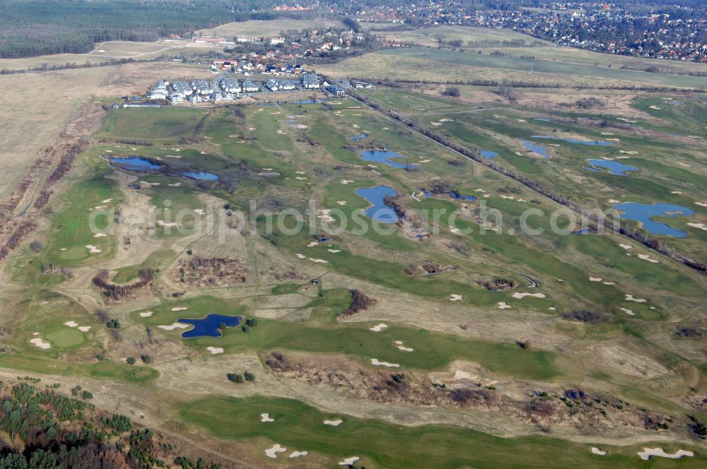
Blick auf den Golfplatz Stolper Heide. Stolpe, seit Bestehen der Siedlung Stolpe-Süd bei Hennigsdorf auch Stolpe-Dorf genannt, ist ein Ortsteil der Stadt Hohen Neuendorf in Brandenburg. Der Ort grenzt an den nördlichen Stadtrand von Berlin und war Übergang der innerdeutschen Grenzen. Kontakt: Golfclub Stolperheide e.V., Am Golfclub 1, 16540 Hohen Neuendorf / OT Stolpe, Tel.: 03303-549214,
HOHEN NEUENDORF / OT STOLPE 16.02.2008
Aerial image ID: 77763
Image resolution: 4288 x 2848 pixels x 24 bit
compressed image file size: 3,02 MB
Image file size: 34,94 MB
Sources and credit: © euroluftbild.de/Robert Grahn
The recording is permitted due to the so-called freedom of panorama according to § 59 UrhG. The provision of Section 59 UrhG conforms to the directive based on Art. 5 Para. 3 Letter c of Directive 2001/29/EC of the European Parliament and of the Council of May 22, 2001 on the harmonization of certain aspects of copyright and related property rights in the information society ("InfoSoc-RL") to be interpreted. The directive-compliant interpretation shows that aerial photographs are also covered by § 59 Para. 1 UrhG and the use of tools does not lead out of the protective barrier. www.klebba.legal