Aerial image 84154
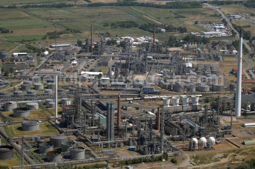
Blick auf die Erdölraffinerie in Hemmingstedt. Sie ist einer der größten Arbeitgeber im Kreis und Grund dafür, dass auf Hemmingstedt als eine der wenigen Dithmarscher Gemeinden im Zweiten Weltkrieg Bombenangriffe geflogen wurden, mit entsprechenden Auswirkungen auf das Stadtbild. In der Raffinerie, die ehemals der DEA und seit der Fusion zu Shell gehört, werden im Jahr etwa vier Millionen Tonnen Rohöl verarbeitet. Dabei entstehen unter an derem Dieselkraftstoff, leichtes Heizöl, Flugturbinenkraftstoff und Grundstoffe für die chemische Industrie (Ethylen, Benzol, Ethylbenzol).
Kam das Öl ursprünglich aus dem Ölfeld zwischen Hemmingstedt und Heide, so kam später über den Hafen Brunsbüttel importiertes Öl hinzu. 1991 versiegte das Feld bei Hemmingstedt, mittlerweile kommt aber etwa ein Drittel des Rohstoffs aus dem im nahen Watt gelegenen Ölfeld Mittelplate. Kontakt: Meldorfer Str. 43, 25770 Hemmingstedt, Tel. +49 (0)481 6930, Fax +49 (0)481 6932382
HEMMINGSTEDT 26.06.2008

Aerial image ID: 84154
Image resolution: 4288 x 2848 pixels x 24 bit
compressed image file size: 4,03 MB
Image file size: 34,94 MB
Sources and credit: © euroluftbild.de/Robert Grahn
The recording is permitted due to the so-called freedom of panorama according to § 59 UrhG. The provision of Section 59 UrhG conforms to the directive based on Art. 5 Para. 3 Letter c of Directive 2001/29/EC of the European Parliament and of the Council of May 22, 2001 on the harmonization of certain aspects of copyright and related property rights in the information society ("InfoSoc-RL") to be interpreted. The directive-compliant interpretation shows that aerial photographs are also covered by § 59 Para. 1 UrhG and the use of tools does not lead out of the protective barrier. www.klebba.legal
