Aerial Photo Database
Fulltext
  • Fulltext
  • Place

Search for place, image id, term(s)

Only search for place

Aerial photograph 109745
Blick auf den Berliner Stadtteil Mitte nach dem Zweiten Weltkrieg. Im Bildzentrum das Rote Rathaus oberhalb davon die verbliebenen Häuser der Rathausstrasse, links die Ruine der Nikolaikirche und der Spree - Verlauf bis zum Berliner Dom.

BERLIN 05.11.1964

Aerial photograph Berlin - Blick auf den Berliner Stadtteil Mitte nach dem Zweiten Weltkrieg. Im Bildzentrum das Rote Rathaus oberhalb davon die verbliebenen Häuser der Rathausstrasse, links die Ruine der Nikolaikirche und der Spree - Verlauf bis zum Berliner Dom.
https://www.aerialphotosearch.com/info/aerial-photos/blick-berliner-stadtteil-mitte-nach-zweiten-weltkrieg-bildzentrum-rote-rathaus-oberhalb-davon-verbliebenen-huser-rathausstrasse-links-ruine-nikolaikirche-spree-verlauf-bis-zum-berliner-dom-109745.html https://www.aerialphotosearch.com/info/aerial-photos/blick-berliner-stadtteil-mitte-nach-zweiten-weltkrieg-bildzentrum-rote-rathaus-oberhalb-davon-verbliebenen-huser-rathausstrasse-links-ruine-nikolaikirche-spree-verlauf-bis-zum-berliner-dom-109745.html

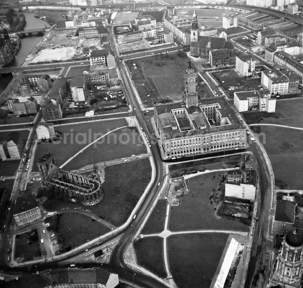
Photo: Lothar Willmann

Aerial image ID: 109745
Image resolution: 4821 x 4579 pixels x 8 bit
compressed image file size: 9,6 MB
Image file size: 21,05 MB
Sources and credit: © euroluftbild.de/Lothar Willmann

All information gathered here in picture and word represent a non-binding information offer to you, which was compiled from trustworthy media. Objections or correction notes please to info@euroluftbild.de - Media licenses according to MfM table!

Keywords