Aerial photograph 222217
Beltringhalder Koog in Nordstrand in the state of Schleswig-Holstein. A polder is a low-lying tract of land enclosed by embankments and reclaimed from the North Sea. The Beltringhalder polder is part of the Wadden Sea in the area of the Bay of Nordstrand. The levee connects the former island of Nordstrand with the mainland
NORDSTRAND 03.06.2010
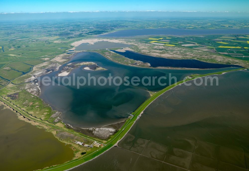
Beltringhalder Koog in Nordstrand in the state of Schleswig-Holstein. A polder is a low-lying tract of land enclosed by embankments and reclaimed from the North Sea. The Beltringhalder polder is part of the Wadden Sea in the area of the Bay of Nordstrand. The levee connects the former island of Nordstrand with the mainland. Photo: Gerhard Launer
Aerial image ID: 222217
Image resolution: 7205 x 4961 pixels x 24 bit
compressed image file size: 11,9 MB
Image file size: 102,26 MB
Sources and credit: © euroluftbild.de/Gerhard Launer
The recording is permitted due to the so-called freedom of panorama according to § 59 UrhG. The provision of Section 59 UrhG conforms to the directive based on Art. 5 Para. 3 Letter c of Directive 2001/29/EC of the European Parliament and of the Council of May 22, 2001 on the harmonization of certain aspects of copyright and related property rights in the information society ("InfoSoc-RL") to be interpreted. The directive-compliant interpretation shows that aerial photographs are also covered by § 59 Para. 1 UrhG and the use of tools does not lead out of the protective barrier. www.klebba.legal
Position: 54° 32' 4.76'' N / 8° 54' 7.11'' E